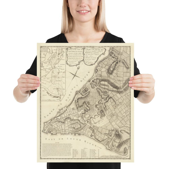
Old Map of New York in 1775 by John Rocque - Rare American Revolution War Wall Art - Greenwich, Columbia, Manhattan - British Military Plan
Old Map of New York in 1775 by John Rocque - Rare American Revolution War Wall Art - Greenwich, Columbia, Manhattan - British Military Plan


Couldn't load pickup availability

Old Map of New York in 1775 by John Rocque - Rare American Revolution War Wall Art - Greenwich, Columbia, Manhattan - British Military Plan
🔒 Order with Confidence
🔒 Order with Confidence
✅30-Day Money Back Guarantee — no risk trying it.
🚚Free shipping available. Orders processed within 24–48 hours.
🔐Secure & encrypted checkout with trusted payment providers.
Behold - the first large scale plan of New York City, drafted and printed on the eve of the Revolutionary War in 1775. Compiled by engineer John Montresor, and then engraved by John Rocque, this map was used by the British army to invade and capture New York and New Jersey in 1776 and 1777 at the start of the revolutionary war.
This map looks great at all sizes from 12x16 inches (30x40cm), to 16x20 inches (40x50cm) and 18x24 inches (45x60cm). But it looks even better when printed large. I can create beautiful, large prints of this map up to 3 meters (120 inches) tall. Please get in touch if you're looking for larger, customised or different framing options.
The model in the listing images is holding the 16x20 inch (40x50cm) version of this map.
Inset in the top left is a map of the New York harbour area, showing the route into Manhattan and New Jersey from Sandy Hook, past Staten Island and Long Island.
This is the first map ever printed to show King's College (now Columbia University) at its original site in Lower Manhattan.
As you can see, Manhattan was mostly empty back in 1775, except for a few blocks in the bottom left corner and Greenwich Village.
There are a few estates from rich and important families shown on this map, including Bayard, Rutgers and de Lancey.
All in all, this is one of the most significant historical maps of New York ever produced. Please take a look at the close-up images to see some of the beautiful details, and how it has been restored by the Unique Maps Co. I guarantee you cannot get this map, at this high quality, anywhere else.
This would make a wonderful birthday or housewarming gift for someone from New York, or perhaps a revolutionary war history buff.
You can order the map itself, or you can order a framed version. The frame is a nice, simple black frame that really makes our maps pop out when on a wall. Please get in touch if you'd like a different frame. We use super-clear acrylic (perspex/acrylite) in our frames - it's less reflective than glass and better for transport.