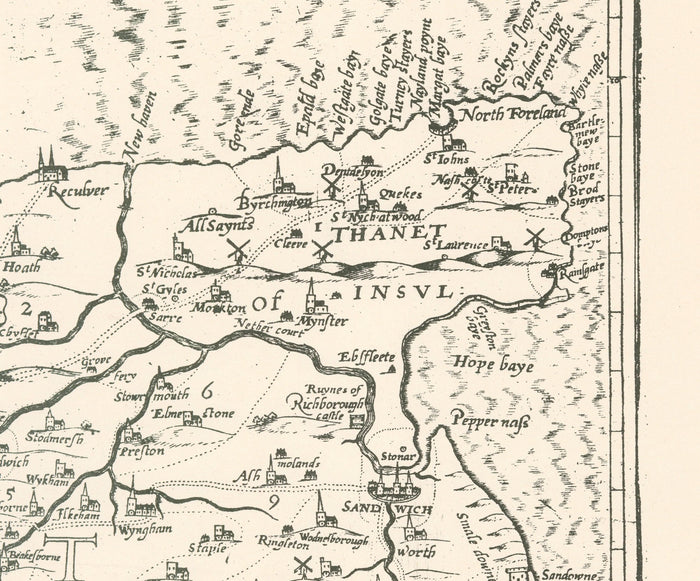
Old map of Kent in 1596 by Philip Symonson - Dartford, Maidstone, Bromley, Tunbridge, Gillingham, Chatham
Old map of Kent in 1596 by Philip Symonson - Dartford, Maidstone, Bromley, Tunbridge, Gillingham, Chatham


Couldn't load pickup availability

Old map of Kent in 1596 by Philip Symonson - Dartford, Maidstone, Bromley, Tunbridge, Gillingham, Chatham
🔒 Order with Confidence
🔒 Order with Confidence
✅30-Day Money Back Guarantee — no risk trying it.
🚚Free shipping available. Orders processed within 24–48 hours.
🔐Secure & encrypted checkout with trusted payment providers.
A truly wonderful map of Kent based on the travels of Philip Symonson in 1596 and engraved by Charles Whitwell. What's really amazing is how almost all of Kent's towns, villages and cities already exist in 1596. There's Canterbury, Dover, Rye, Tunbridge and Thanet of course, but also villages like Edenbridge, Hever, Orpington and Maidstone (or Maydston as it was spelt back then).
This map looks great at all sizes: 12x16 inches (31x41cm), 18x24 inches (45.5x61cm) and 24x36 inches (61x91.5cm), but it looks even better when printed large.
I can create beautiful, large prints of this map up to 52x70 inches (130x180cm). Please get in touch if you're looking for larger, customised or different framing options.
The model in the listing images is holding the 36x24 inch (90x60cm) version of this map.
Some other Kent towns and villages visible in this map: Chislehurst, Whitstable, Herne Bay, Broadstairs, Deal, Folkestone, Dartford, Gravesend, Rochester, Margate and more.
In the northwest you can see London, which was just a little city back then, surrounded by towns like Newington, Camberwell and Shoreditch.
This would make a wonderful birthday, Christmas, Father's Day, work leaving or housewarming gift for someone from the towns and villages in Kent or someone who has a close connection to Kent.
I also have this 1611 version of this map, in handcoloured form by John Speed. Depending on your room’s aesthetic/decor, you might prefer this version.
This map is available as a giclée print on acid free archival matte paper, or you can buy it framed. The frame is a nice, simple black frame that suits most aesthetics. Please get in touch if you'd like a different frame colour or material. My frames are glazed with super-clear museum-grade acrylic (perspex/acrylite), which is significantly less reflective than glass, safer, and will always arrive in perfect condition.