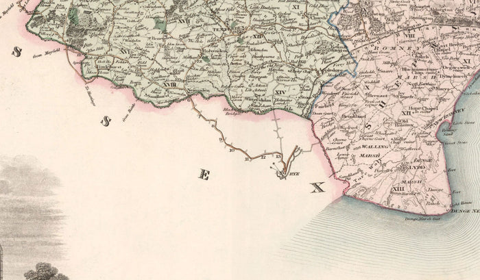
Old Map of Kent, 1829 by Greenwood & Co. - Canterbury, Maidstone, Bromley, Tunbridge, Margate
Old Map of Kent, 1829 by Greenwood & Co. - Canterbury, Maidstone, Bromley, Tunbridge, Margate
Excellent 4.9
19,544 Reviews
Trustpilot


465 sold in the past 24 hours
401 people are viewing this item
Only 1% left in stock
Regular price
$46.23
Regular price
$46.23
Sale price
$67.00
Unit price
per
Couldn't load pickup availability

Old Map of Kent, 1829 by Greenwood & Co. - Canterbury, Maidstone, Bromley, Tunbridge, Margate
Regular price
$46.23
Regular price
$46.23
Sale price
$67.00
Unit price
per
🔒 Order with Confidence
🔒 Order with Confidence
✅30-Day Money Back Guarantee — no risk trying it.
🚚Free shipping available. Orders processed within 24–48 hours.
🔐Secure & encrypted checkout with trusted payment providers.
This old, full colour and wonderful map shows the county of Kent as it was in 1829. Published in Greenwood's Atlas of England & Wales and engraved by J & C Walker, this is one of the finest old county maps from the 1800s.
I can create beautiful, large prints of this map up to 70 inches wide (175cm). Please get in touch if you're looking for larger, customised or different framing options.
Many of the towns, villages and cities in Kent are already visible in this map.
In the bottom left corner of the map is a detailed engraving of Canterbury Cathedral.
Take a look at the detailed images and try to spot your hometown!
Somewhat unusually, this map also includes polling locations for county elections, parishes, churches, windmills, watermills, railways and much more.
This would make a wonderful gift for someone from Kent or who has Kent in their heart.
You can order the map itself, or you can order a framed version. The frame is a nice, simple black frame that really makes our maps pop out when on a wall. Please get in touch if you'd like a different frame. We use super-clear acrylic (perspex/acrylite) in our frames - it's less reflective than glass and better for transport.
View full details
I can create beautiful, large prints of this map up to 70 inches wide (175cm). Please get in touch if you're looking for larger, customised or different framing options.
Many of the towns, villages and cities in Kent are already visible in this map.
In the bottom left corner of the map is a detailed engraving of Canterbury Cathedral.
Take a look at the detailed images and try to spot your hometown!
Somewhat unusually, this map also includes polling locations for county elections, parishes, churches, windmills, watermills, railways and much more.
This would make a wonderful gift for someone from Kent or who has Kent in their heart.
You can order the map itself, or you can order a framed version. The frame is a nice, simple black frame that really makes our maps pop out when on a wall. Please get in touch if you'd like a different frame. We use super-clear acrylic (perspex/acrylite) in our frames - it's less reflective than glass and better for transport.