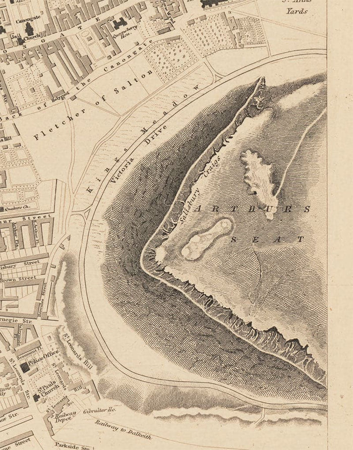
Old Map of Edinburgh, Scotland in 1853 by WB Clarke and George Cox - Waverley, Old Town, New Town, Castle, Railway, Arthurs Seat
Old Map of Edinburgh, Scotland in 1853 by WB Clarke and George Cox - Waverley, Old Town, New Town, Castle, Railway, Arthurs Seat


Couldn't load pickup availability

Old Map of Edinburgh, Scotland in 1853 by WB Clarke and George Cox - Waverley, Old Town, New Town, Castle, Railway, Arthurs Seat
🔒 Order with Confidence
🔒 Order with Confidence
✅30-Day Money Back Guarantee — no risk trying it.
🚚Free shipping available. Orders processed within 24–48 hours.
🔐Secure & encrypted checkout with trusted payment providers.
This rare, colour map of central Edinburgh was drawn by W.B. Clarke and published by George Cox in 1853.
Like many old cities, you can see that central Edinburgh hasn't fundamentally changed in at least 150 years! The central area of Queen Street, George Street and Princes Street has already been laid down. Obviously Calton Hill and Arthurs Seat haven't moved.
This map looks great at all sizes: 12x16 inches (31x41cm), 18x24 inches (45.5x61cm) and 24x36 inches (61x91.5cm), but it looks even better when printed large.
I can create beautiful, large prints of this map up to 37x50 inches (95x125cm). Please get in touch if you're looking for larger, customised or different framing options.
The model in the listing images is holding the 20x16 inch (51x40.5cm) version of this map.
If you’re looking for something slightly different, another option would be this amazing map of the same area by Clarke in 1834. Notably, unlike my other Edinburgh map from 1834, Edinburgh Waverly station has been built in the centre of town on this one.
Even the Edinburgh and Glasgow railway already exists with the central city Canal Street station - a street and station that no longer exists, instead replaced by Edinburgh Waverley.
The Water of Leith is coloured a lovely blue and wends its way across the left side of the map. A highly detailed engraving of Edinburgh Castle is inset on the left.
A nice touch on this map is that you can see where buildings and streets are scheduled to be built but haven't yet been constructed.
This would make a wonderful birthday, Christmas, Father's Day, work leaving or housewarming gift for someone who is a proud Scot or someone who finds themselves connected to Edinburgh.
This map is available as a giclée print on acid free archival matte paper, or you can buy it framed. The frame is a nice, simple black frame that suits most aesthetics. Please get in touch if you'd like a different frame colour or material. My frames are glazed with super-clear museum-grade acrylic (perspex/acrylite), which is significantly less reflective than glass, safer, and will always arrive in perfect condition.